


MOUNT VALLEY TWP Voting District, Winnebago County, Iowa
About
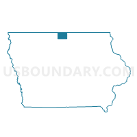
Outline

Summary
| Unique Area Identifier | 583721 |
| Name | MOUNT VALLEY TWP Voting District |
| County | Winnebago County |
| State | Iowa |
| Area (square miles) | 36.22 |
| Land Area (square miles) | 36.22 |
| Water Area (square miles) | 0.00 |
| % of Land Area | 99.99 |
| % of Water Area | 0.01 |
| Latitude of the Internal Point | 43.30487400 |
| Longtitude of the Internal Point | -93.56726320 |
Maps


Graphs
Select a template below for downloading or customizing gragh for MOUNT VALLEY TWP Voting District, Winnebago County, Iowa


Neighbors
Neighoring Voting District (by Name) Neighboring Voting District on the Map
- BRISTOL TWP Voting District, Worth County, IA
- CENTER TWP W/O LAKE MILLS Voting District, Winnebago County, IA
- ELLINGTON TWP W/O FOREST CITY Voting District, Hancock County, IA
- FERTILE TWP W/O FERTILE & HANLONTOWN Voting District, Worth County, IA
- FOREST CITY IN HANCOCK COUNTY W/MADISON TWP PART Voting District, Hancock County, IA
- FOREST CITY IN WINNEBAGO COUNTY W/FOREST TWP PART Voting District, Winnebago County, IA
- FOREST TWP PART W/O FOREST CITY & LELAND Voting District, Winnebago County, IA
- GRANT TWP Voting District, Cerro Gordo County, IA
- NEWTON TWP Voting District, Winnebago County, IA
Top 10 Neighboring County Subdivision (by Population) Neighboring County Subdivision on the Map
- Forest township, Winnebago County, IA (4,611)
- Center township, Winnebago County, IA (2,470)
- Fertile township, Worth County, IA (807)
- Madison township, Hancock County, IA (714)
- Mount Valley township, Winnebago County, IA (565)
- Bristol township, Worth County, IA (471)
- Ellington township, Hancock County, IA (456)
- Grant township, Cerro Gordo County, IA (347)
- Newton township, Winnebago County, IA (211)
Top 10 Neighboring Place (by Population) Neighboring Place on the Map
Top 10 Neighboring Unified School District (by Population) Neighboring Unified School District on the Map
Top 10 Neighboring State Legislative District Lower Chamber (by Population) Neighboring State Legislative District Lower Chamber on the Map
Top 10 Neighboring State Legislative District Upper Chamber (by Population) Neighboring State Legislative District Upper Chamber on the Map
Top 10 Neighboring 111th Congressional District (by Population) Neighboring 111th Congressional District on the Map
Top 10 Neighboring Census Tract (by Population) Neighboring Census Tract on the Map
- Census Tract 9508, Cerro Gordo County, IA (5,002)
- Census Tract 6801, Winnebago County, IA (4,145)
- Census Tract 6803, Winnebago County, IA (3,979)
- Census Tract 2701, Hancock County, IA (3,876)
- Census Tract 2702, Hancock County, IA (2,592)
- Census Tract 6902, Worth County, IA (2,317)
Top 10 Neighboring 5-Digit ZIP Code Tabulation Area (by Population) Neighboring 5-Digit ZIP Code Tabulation Area on the Map
- 50428, IA (9,384)
- 50436, IA (5,848)
- 50450, IA (2,897)
- 50453, IA (588)
- 50446, IA (548)
- 50434, IA (498)